Charter
- Home
- Itineraries
- Western Sardinia
Recommended for experienced sailors capable of interpreting weather reports to avoid being caught by the mistral in some poorly protected roadsteads.
This is a challenging itinerary, but you will be surprised by the historical and natural treasures set in an area of Sardinia waiting to be discovered.
After leaving the Island of San Pietro, an evocative journey begins in an unconventional Sardinia. Forget the classic postcard images; this part of Sardinia is wild and unknown to most.
Discover a side of Sardinia immersed in history and natural beauty:
The stages
- Costa Verde
- Tharros
- Torregrande marina
- Sinis protected sea area - Mal di Ventre
- Capo Mannu
- S'Archittu
- Bosa
- Alghero
- Porto Conte
- Capocaccia
- Stintino
The climate, typically Mediterranean with little rainfall, mostly confined to the winter season, is cooled by the mistral. Given the coast’s exposure to the western side, navigation is suitable for highly experienced crews, especially in a northerly direction – south.
COSTA VERDE
After departing from the Island of San Pietro, an evocative journey unfolds in an unconventional Sardinia. Forget the typical postcard images: as you pass the long beach of Funtanamare to your right, a strip of sand ascends a rocky wall overlooking the sea, adorned with junipers bent by the mistral. Nestled within it, you’ll find an ancient portal: the former entrance to the mines of Porto Flavia, which once provided employment and prosperity to the entire Sulcis Iglesiente region. While mining activities have ceased, the area’s allure remains. The towering rocks of Pan di Zucchero, with their deep sandy seabed, offer a delightful interlude along the northern journey. A visit to the Cala Domestica fjord is essential, as is Buggerru (provided the port’s sandbar obstruction has been cleared). The Costa Verde, named for the verdant vegetation that punctuates the light cliffs, concludes at Arbus before merging into the Oristano area. Ponds, sightings of flamingos, and delectable roasted mullet serve as highlights upon reaching Tharros, where the Phoenician archaeological site of the same name provides a splendid backdrop.
THARROS
The extension of the Punic ruins underwater makes access along the coast impossible; the boundary is marked by a special buoy field. It is better to plan a visit from land after landing at the Marina di Torregrande, which allows for a necessary stop to reorganize ideas and emotions before sailing towards the northern tip of the coast.
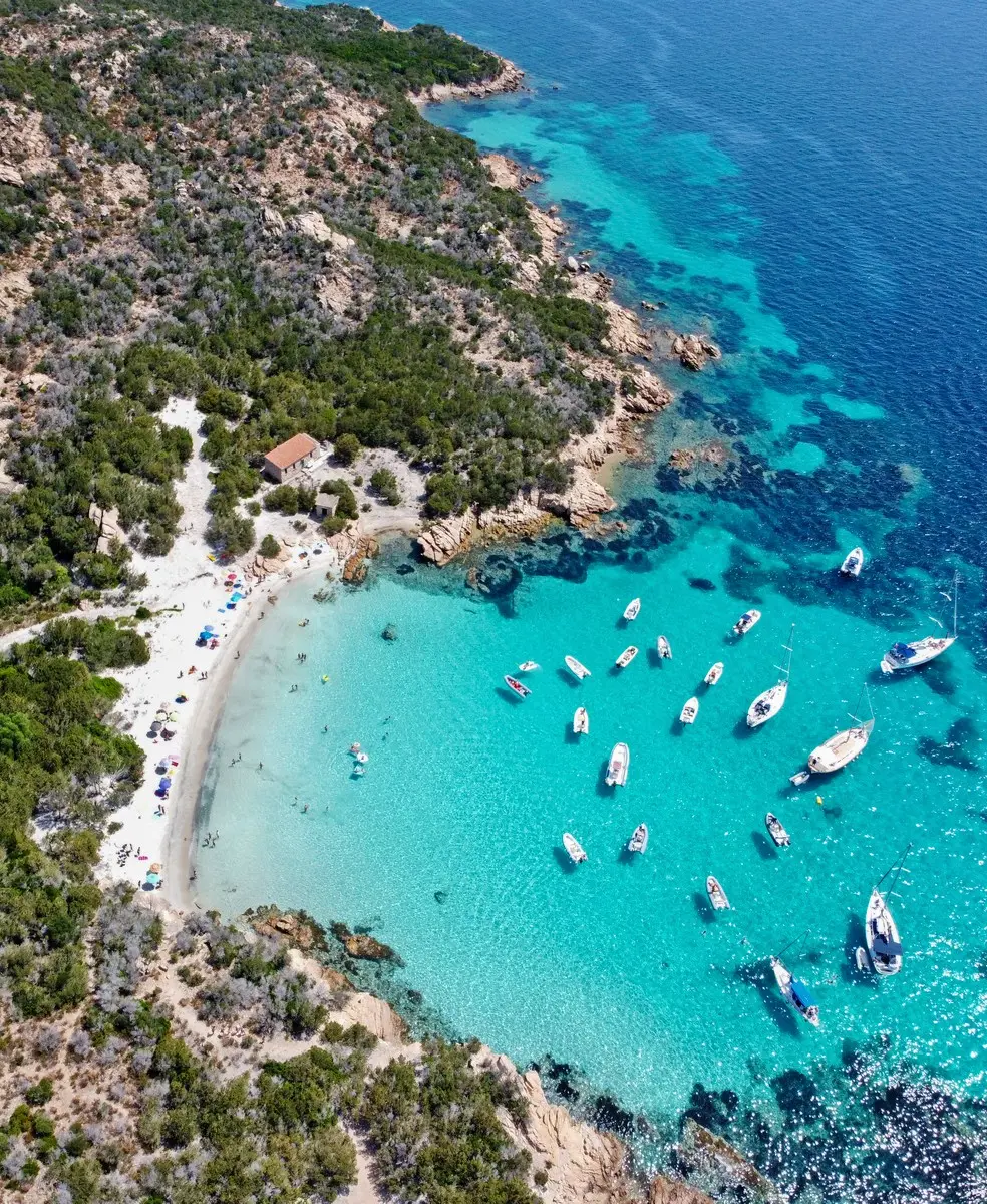
SINIS PROTECTED SEA AREA – MAL DI VENTRE
Once past Capo San Marco, the Sinis Mal di Ventre Marine Protected Area begins. This area includes the island of the same name and spans 25 hectares, divided into three protection zones to ensure sustainable use. The west side (zone A of the reserve, similar to dello Scoglio del Catalano, located six miles further south) is off-limits. However, anchoring is possible at Cala dei Pastori, located in zone C.
CAPO MANNU
Voted by surfers as one of the best spots in the Mediterranean, during mistral storms its waves can reach 5 meters high! From Capo Mannu, the very white beach of Is Arenas stands out. Walking along it, while paying attention to some outcropping rocks, you can glimpse Santa Caterina di Pittinurri and the splendid natural arch of S’Archittu.
S’ARCHITTU
The natural rock arch, standing at 15 meters high, is adored by extreme diving enthusiasts and has frequently served as a location for advertisements and films.
BOSA
Unique in Sardinian geography, Bosa sits on the banks of a river: the Temo, which can be crossed by tender once you’ve left the boat on the floating piers of Bosa Marina (Nautica Pirisi, 0785.375550). Its low and colorful houses, the historic center in Hispanic style topped by the Malaspina Castle which still preserves medieval frescoes, offers a delightful contrast to the naturalistic immersion of the itinerary, along with the excursion into the interior by the Trenino Verde (green train – historical train).
ALGHERO
This beautiful fortified city was born on the sea and owes its name to it. The name likely derives from the abundance of deposits of Posidonia oceanica leaves, mistakenly called algae, present along the sandy coasts, especially after south-westerly storms. Alghero was founded in the 12th century by the Genoese Doria family, but in the following century, it was conquered by the Catalan-Aragonese, who entered the fortified city on August 31, 1353. The following year, the city was repopulated by people from various Catalan territories, and since then, Alghero has preserved the language and traditions of those people and the Iberian peninsula. The monuments and churches of the ancient city, surrounded by imposing towers and bastions as well as stately palaces, retain a clear imprint of the “Gothic-Catalan” style. The agile bell towers of the Cathedral of Santa Maria and the Church of San Francesco are particularly notable. “Barceloneta,” as Alghero is affectionately called by the Catalans, with its sea, history, and people, was the first capital of Sardinian tourism since the end of the 19th century and still represents the city in Sardinia with the greatest traditions of hospitality.
PORTO CONTE
The bay between the harbor of Alghero and the promontory of Capo Caccia, one of the quietest landing points on the Coral Riviera (so called due to the abundance of “red gold” on its seabed), also ideal for an overnight stop on the piers of the marina. It is part of the Capo Caccia – Isola Piana Marine Protected Area and is very popular for the practice of many sea and land sports.
CAPOCACCIA
The imposing promontory that delimits the harbor of Alghero is among the highest in Italy. At 186 meters above sea level, it is visible up to 34 miles away. It is included in the Capo Caccia – Isola Piana Marine Protected Area which also includes the Bay of Porto Conte and the suggestive Neptune’s Caves, the most famous in Sardinia.
STINTINO
The charming town of Stintino overlooks the Gulf of Asinara on the north-eastern coast of Sardinia. It has a precise date of birth: 1885, when the families of fishermen who lived on the island of Asinara were evicted to make room for a penal colony and had to establish a new settlement at Capo Falcone. The origin of the toponym derives from the Sardinian “s’isthintinu,” meaning “the gut,” referring to the narrow fjord on which the town was built. The two ports – Portu Mannu and Portu Minori – are equipped for nautical tourism.
L’ASINARA
A true naturalistic paradise, Asinara is famous for having hosted a penal colony for a long time, which preserved its pristine natural configuration. This is evident in the beauty of the coasts, the colonies of rare and wild animals such as the famous white donkey, and the extraordinary blue shades of the sea. Disembarkation takes place in Fornelli, in the southern gulf of the island, near the buildings of the former penal prison colony. As it is a National Park, permission from the Park Authority is required to reach it by private boats.